Click here for details of terrorist attacks on the London Underground (1885-2005).
COMMENTARIES WILL APPEAR ON MY BLOG
by Nick Cooper © 2002-2010
"London is like some huge prehistoric animal,
capable of enduring terrible injuries,
mangled and bleeding from many wounds,
and yet preserving its life and movement."
These are the words chosen by Winston Churchill to describe the Capital in the aftermath of the Second World War. For many today, the image of people sheltering in the London Underground Railways during the German bombing Blitz is synonymous with the fortitude of the city in the face of the greatest assault it ever suffered, but the role of the network is far wider than simply providing a place of sanctuary. In the terms of Churchill's metaphor, the veins and arteries of that great animal were the roads and railways that - even in the face of such a terrible onslaught and unimaginable damage - kept the city moving. In war, as in peace, the London Underground - less vulnerable than the surface links, but by no means immune - continued to function despite frequent disruption, and the shortage of both personnel and matériel. While journeys on the surface might be subject to countless delays and diversions to avoid bomb damaged or blocked streets, hundreds of thousands of people could still travel to their destinations on the Underground, thus maintaining the commerce and industry of the city itself, as well as the governance of the nation, the Empire, and the Commonwealth in a time of global conflict.
HISTORY
Originally a collection of separate lines run by different commercial interests, the London Underground (LU) only came under a single controlling authority in the 1930s. In some cases, what are single stations "today" were originally adjoining and/or differently named ones belonging to separate lines and/or companies, and it is important to remember that the majority are not in fact deep underground. At the suburban extremities, tracks and stations are on the surface, many of which having been previously run as "ordinary" railways prior to take-over by the LU or its predecessors. The earliest "sub-surface" lines from the 1860s onwards were laid by cutting a deep wide trench, at the bottom of which the tunnel was constructed, before being filled in again. This method was known as "cut and cover," and usually followed the line of major roads, restricting their use for years, although the technique was still being used in the 1970s (e.g. the Piccadilly Line extension to Heathrow Airport). The stations serving these lines are essentially sited in deep walled pits, often - but not always - roofed-over. "Tube" stations proper were constructed with deep tunnelling techniques from the 1890s onwards, and range in depth from less than 50 feet to almost 200 below the surface, generally served with lifts (elevators) and/or escalators. Most sub-surface and tube stations have surface entrance and/or ticket hall buildings, with a wide variance of scale and design. These factors should be considered with regard to bomb damage and also their suitability as an air raid shelter (ARS), the latter obviously not having been a major design consideration when built. The initial principal reference source was David Leboff's London Underground Stations {R15}, which although primarily an architectural/design history, in many cases it confirms the damaged stations/lines listed in the aforementioned newsgroup thread (which I have indicated with an asterisk), but also adds about the same number again, along with other notable wartime detail. During the 1930s, the network was expanding rapidly, and an indirect effect of WW2 was the temporary or permanent shelving of such plans, although I have generally not included details unless there are other relevant factors. In some cases, the names of stations have subsequently changed, and I have used the versions that were current during the War.
OFFICIAL POLICY IN WW2
During World War 1, when London first came under aerial attack from German Zeppelin airships and Gotha bombers, although certain disused sections were put to government use (e.g. "Aldwych," but see also "King William Street"), many members of the public also sought unofficial shelter in the Underground system. Between the Wars, the government policy was that such occupation in the next conflict - when aerial bombing was expected to be far more severe - should be actively discouraged, as it was feared that many Londoners might develop a "deep shelter mentality" and refuse to come back to the surface (it is interesting to note that the 1936 film Things to Come - set in a thinly-disguised London - has civilians fleeing to supposed sanctuary in the Underground system during a surprise enemy bombing attack). With the exception of the converted "Borough" to "King William Street" (qv) branch, official ARS construction was restricted to refuges separate from the Underground system, as well as the small domestic shelters (Anderson and other types). During the light bombing in June 1940 the public shelters did not see much use, but heavy raids on 7 and 8 September led to them being critically overcrowded, with conditions rapidly deteriorating to a dangerous and unhygienic level. Civil disobedience was widespread, with many people seeking shelter in the Underground, and incidents such as those at "Liverpool Street" (qv) led to a reversal of the government policy on the issue.
FLOOD ALLEVIATION MEASURES (FAM)
Around the time of the Autumn 1938 Munich Crisis, preventative measures were taken in case bombing breached the rail tunnels running under the River Thames. This involved nothing more sophisticated than plugging the tunnels with concrete, which obviously meant that they could not be used until the threat of war receded and the obstructions were removed. On the day Poland was invaded in September 1939 - and pre-empting the British declaration of war - more practical plans were initiated, with the installation of remotely controlled flood barriers at the most vulnerable points on the network, with additional sites being addressed soon afterwards. Although trains running under the Thames were halted during air-raids when the water-tight doors were closed, this allowed normal services at other times. Similar measures were taken at stations in the vicinity of water mains (e.g. "Tooting Broadway"), principally to block street access with concrete plugs, although some underground interchange facilities between different lines were unaffected. Despite appearances, these heavy steel doors were not proof against blast, and were normally left open, the consequence of not doing so being highlighted after the incident at Bank (qv). {R15/R14/HO 186/639}
DEEP-LEVEL SHELTERS (DLS)
After the bombing of mid/late-1940, in the October of that year it was decided to build a number of large deep-level shelters adjacent to existing Tube stations, eight on the Northern Line - "Belsize Park," "Camden Town," (both replacing the early considerations of "Mornington Crescent" and "Warren Street"; "Leicester Square" was similarly ruled out at an early stage) "Goodge Street," "Oval," "Stockwell," "Clapham North," "Clapham Common" and "Clapham South" (all qv) - and three on the Central at "Chancery Lane" and "St Paul's" (both qv), and midway between "Bethnal Green" (qv) and "Liverpool Street."
Although all were connected to their Tube station proper, access was normally via separate double spiral staircases and lift shafts at each end. In order to avoid a repetition of the devastating effects of the direct hits at "Bank," "Balham," and "Trafalgar Square" (all qv), the heads of the staircases were protected by heavy concrete blockhouses, all of which survive with the exception of those at "Chancery Lane." Construction of the first ten shelters began on 27 November 1940, but in mid-1941 it was decided that no more would be built, although the existing ones would be completed. The shelters at "Oval," "St Paul's" and "Bethnal Green" were not fully constructed, but the others were finished by 1942 and subsequently enjoyed a variety of uses. Each shelter was built to hold approximately 8,000 people at a cost of £35-42 per person, although the original estimate was 9,600 at £15 per head. The shelters were divided up into different sections, each named after a famous historical figure to make it easier for the users to find their way around.
After the cessation of hostilities it was planned to link the shelters together to form an "Express Tube" system, alleviating existing lines, although this was not eventually done (the diameter of the shelter bores were the standard for running tunnels, and not stations, indicating that these were ones the express lines would bypass). Although a similar high-speed track had been planned in the 1890s (see "South Kensington"), the later scheme may have had its genesis in a 1936 visit by a London Passenger Transport Board (LPTB) team to New York, where such lines had been utilised to great effect. {R15/R14/R16/R02/R12/Rc/Rg/Rd} See also "Gants Hill." {R10}
The deep-level shelters were an "open secret," with the one at "Goodge Street" and the station proper featuring in a 1968 story in the BBC TV drama series Doctor Who (The Web of Fear) in a studio mock-up form so convincing that London Transport even complained about "unofficial filming" on its property! A number of scenes in Stephen Poliakoff's film Hidden City were set and shot in the real DLS itself, although it is not named in the narrative. Many of the DLSs are currently leased to a variety of companies for secure storage purposes.
"The tunnel shelters, completed in 1942, are all similar. Each lies directly beneath its Underground station... Each shelter consisted of two parallel, 1,200-foot tunnels, divided into an upper and lower floor, and furnished with iron bunks. There were extensions at right angles for first-aid posts, wardens' rooms, ventilation equipment and lavatories - which posed a particular problem, since the shelters were below the level of the sewage system:
"At each shelter, eight lavatory tunnels were driven 12 feet in diameter. Closets are of the Elsan type. At the far end of each lavatory a hopper has been installed into which closets are emptied. To keep out bottles, boots, clothing etc. all of which have been found to give trouble in other shelters, it was necessary to install a wire screen. The hoppers are connected by piping to a closed ejector placed in the bottom of the staircase shafts, and the contents of the ejector periodically forced out by means of compressed air through a rising main, 6 in. diameter, up to sewer level in the street above." (The Engineer, 18 September 1942) {R16}
HO 196/11 - THE PHILLIPS REPORT
A report dated 26/03/42 was produced by a Dr Phillips for the Ministry of Home Security's Research and Experiments Department entitled Notes on damage to railway tunnels by high explosive weapons, Section 1 - Tube railways (Section 2 dated 06/04/42 dealt with non-Tube railway tunnels). In his report, Phillips assessed bombing incidents that had affected LU Tube tunnels, quantifying the damage caused in relation to the size of the explosion, the proximity to the tunnel, and the nature of the tunnel itself. An appendix to the report detailed all such incidents to date, and while all station names were omitted - presumably for security reasons - most can be "mapped" back to the corresponding event.
CASUALTY & FATALITY ANALYSIS (C&FA)
Work is currently underway by the author to reconcile the various previously-published figures for casualties and fatalities associated with the Underground network during WW2 with the Commonwealth War Graves Commission's records of Civilian War Dead. At present, this has been completed for the following incidents:
Balham - 14/10/40
Bank - 11/01/41
Bounds Green - 13/10/40
Camden Town - 14/10/40
Chalk Farm - 17/04/41
Charing Cross - 08/10/40
Colindale 25/09/40
Green Park - 11/01/41
Kings Cross - 09/03/41
Lambeth North - 16/01/41
Paddington (Praed Street) 13/10/40
Trafalgar Square - 12/10/40
Turnpike Lane - 05/01/41
In progress:
Bethnal Green - 03/03/43
Marble Arch - 17/09/40
THE STATIONS
"Aldersgate & Barbican" [now "Barbican" - Circle/Metropolitan
(now part Hammersmith & City) lines, sub-surface]
Severe bomb damage to station building, demolished 1955. {R15}
"Aldwych" [Piccadilly, tube]
The terminus of a short and little-used link to "Holborn" (qv), ¾ mile
away, formed when two planned pre-LU lines were merged prior to the construction.
It was originally called "Strand," but this was changed quite early in its
working life to avoid confusion with the nearby Northern Line station of
the same name (qv). Initially served by two tunnels from "Holborn," customer
demand was never high, so one line was closed quite early on, with the remaining
track operating a shuttle service only from what was originally designated
the Northbound platform. Station closed 22/09/40-30/06/46 and used by Westminster
City Council as a public ARS, while the already-disused tunnel to "Holborn"
- which in WW1 had been used as a shelter by the War Cabinet during Zeppelin
raids - housed British Museum exhibits, including the Elgin Marbles. The
London Transport Museum organises occasional tours of the station - which
finally closed in 1994 - and there is an online version on their web-site.
{R15/R07/R03/Rf/Re} Since even before it finally closed "Aldwych" was for
many years only open for weekday rush-hour services, it was often used by
film-makers needing an authentic Underground station location. In both
Battle of Britain (1966) and The Krays (1989)
it was used to re-stage scenes of civilians sheltering during the Blitz,
in the former standing in for the more appropriate "Bethnal Green." The L-shaped
building is situated at the junction of The Strand and Surrey Street, with
the large portion in the latter.


"Alperton" [Piccadilly, surface]
Bomb 02/03/44 prevented through service for five days. {R07}
"Arnos Grove" [Piccadilly, surface]
Explosion of 1000lb bomb 16/11/40 to the west of the station caused slight
damage and partial flooding of platform track area resulting from a fractured
water main. Further damage and service to Oakwood disrupted due to bombing
19/04/41. {R01}
"Arsenal" [Piccadilly, tube]
Temporarily closed/access restricted for FAM 07/09/39-01/12/39. {R14/R07}
"Baker Street" {Metropolitan, surface; Circle/Hammersmith & City,
sub-surface; Bakerloo, tube]
Bomb damage to parts of surface structure. {R15} Heavy steel flood doors
are visible at the head of the escalator leading to the Bakerloo section.
"Balham" [Northern, tube]
Temporarily closed/access restricted for FAM from 07/09/39. {R14} Direct
hit on road junction 14/10/40 caused extensive damage to the platforms, and
killed 64 people sheltering from the air raid, plus four members of the station
staff. The tunnels to within 100 yards of "Clapham South" were filled with
soil, and water and gas from fractured mains. A legacy of the post-bomb damage
rebuilding is the absence of trackside tiling at the northern ends of the
platform tunnels. {R15/R14/R11} Of 600 shelterers, 68 killed. {R02}* A memorial
plaque in the sub-surface ticket hall (to the right of the ticket barriers
on entry) reads: "In memory of the 64 people killed at this station by a
wartime bomb 14th October 1940."
According to Phillips, a large number of segments of 24 rings of the tunnel
directly below the blast collapsed, causing the complete blockage of 26 feet
of the tunnel, and partial blockage over a further 370 feet, as well as flooding.
Debris was washed into the other tunnel, where segments of around 40 rings
had cracked, the tunnel being distorted in shape by up to 1¾-inches.
After the fractured sewers had been blocked, the water was pumped out and
the debris cleared up to the crater above. The damaged tunnel segments were
then either repaired or replaced. Traffic was resumed in both tunnels within
two months. {HO196/11#1}
Provisional C&FA: 66 killed or died
at scene. Total = 66.
"Bank" [Central/Northern, tube]
Northern line platforms only closed for FAM 07/09/39-18/05/40. {R15/R14}
At 19:59 on 11/01/41, a bomb pierced the road surface, the Central line passenger
concourse below it, and exploded in the escalator machine room. The blast
carried down the escalator shaft, killing 56 and seriously injuring 69, as
well as damaging trains at the platforms and causing a 120ft crater across
the road junction. {R15/R10}* The initial Civil Defence report noted:
"At the foot of the escalator to the Central London railway there are two steel doors for the prevention of floods giving access to each side of the tube platforms. These doors were open and the main casualties were those sheltering at the foot of the escalator, who were blown through the doors against the wall of the tube opposite. Had these doors been shut, the technical officer of the Transport Board advises that the blast might have blown in the sides of the tube tunnels." {HO186/639}
53 shelterers killed. {R11} See also "City."
C&FA: 46 killed or died at scene, 11
injured died in hospital. Total = 57.
"Barbican" [current Circle/Metropolitan/Hammersmith & City] - see "Aldersgate & Barbican"
"Belsize Park" [Northern, tube]
Adjacent DLS (qv) used as a public ARS from 23/07 to 21/10/44, when this
function ceased due to low usage (shelter allocation transferred to Camden
Town). There are conflicting reports as to whether or not it had been previously
used as a troop hostel from 1943. The DLS sections were named after famous
explorers (e.g. Livingstone, Rhodes, etc.). {R09/R16/Rd}


"Bethnal Green" [Central, tube]
This was the first station on a major eastern extension of the Central line,
but at the start of WW2 the tunnel bore from "Bethnal Green" fell one-third
of a mile short of "Liverpool Street" (qv) - which was to have been linked
to the existing "Bank" (qv) terminus - although it had reached "Mile End"
(sub-surface) in the opposite direction. "Bethnal Green" was used unofficially
by shelterers in the first days of the Blitz, but was closed because of the
danger of flooding. It was reopened as a public ARS on 05/10/40, along with
about a mile of the incomplete tunnel towards "Liverpool Street." The official
capacity was in excess of 10,000 - over 5,000 in bunked accommodation and
around the same again unbunked. Short sections of unopened extension tunnel
beyond "Mile End" at "Leyton," "Leystonstone," and "Stratford" stations were
also utilised as shelters. While used by as many as 7,000 shelterers during
the intensive bombing of 1940-41, by 1943 demand at "Bethnal Green" had declined
to around just 200-300, rising only in the days following reported heavy
Allied raids on Berlin, when retaliatory bombing on London was anticipated.
On 02/03/43 it was reported that there had been a heavy raid on Berlin the
day before, with the result that 850 people used the shelter. At 20:17 on
03/03/43, the alert sounded and people began to enter "Bethnal Green" station
- initially in a calm and orderly fashion - to join the 500-600 already inside.
At 20:27 a salvo of a new type of anti-aircraft rocket was launched one-third
of a mile away. In panic, many people in the street threw themselves to the
ground in reaction to the unfamiliar sound, while the crowd entering the
shelter surged forwards. Whether as a result of this, or coincidental with
it, a woman with a child tripped at the bottom of the 19-step stairway leading
down from the entrance to the booking hall. In the resultant crush, 172 people
suffocated, and of those admitted to hospital, one subsequently died and
62 were retained overnight, only 30 of them being discharged within the following
week. Subsequent Nazi propaganda radio broadcasts cited it as an example
of "panic" amongst Londoners in reaction to German bombing. The Government
Inquiry into the tragedy came to the conclusion that the single entrance
to the shelter - being at an angle to the adjacent pavement - was a natural
bottleneck that allowed more people to enter than the stairway could accommodate
in such a surge, while the lack of adequate lighting and crush-barriers to
restrict the flow contributed to the tragedy. It was recognised that while
there was not sufficient police or Shelter Warden provision, this was not
unique to "Bethnal Green," and was the result of the overall shortage of
man-power in light of the numbers called up for the armed services. A memorial
plaque at the station reads:
SITE OF THE WORST CIVILIAN DISASTER
IN MEMORY OF NOT FORGOTTEN |
{R15/R10/R17} Work on a DLS at a point midway between "Bethnal Green" and "Liverpool Street" was abandoned due to persistent flooding. {R09}
"Blackfriars" [Circle/District, sub-surface]
Top two floors of four-storey surface building destroyed by bomb in 1940.
{R15}
"Bond Street" [Central/Bakerloo (now Jubilee), tube]
Temporarily closed/access restricted for FAM from 07/09/39. {R14}
"Borough" [Northern, tube]
The original 1890 terminus north of this station was at "King William Street"
(qv), which closed in 1900 when bypassed by a new alignment to "London Bridge."
At the outbreak of WW2, the London Borough of Southwark successfully applied
to use the former running tunnels at the "Borough" end as a public ARS, and
work began in January 1940 to sink six new staircases down to them,. and
to seal off the section that ran underneath the Thames at both ends. The
staircases would allow the admission of 300 persons per minute, to a maximum
capacity of 14,000, and the shelter opened 26/06/40. A plaque on the side
on the station building records this usage:
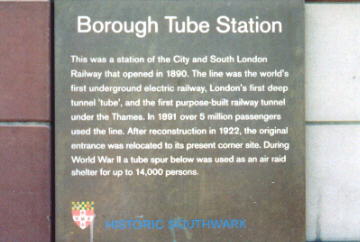
V2 ballistic missile impacted near station 22/01/45. Resultant blast damage closed station to shelterers for two nights. {R11}
"Bounds Green" [Piccadilly, tube]
Bomb from a aircraft flying out of formation demolished two three-storey
houses north of the station, causing the collapse of the northern (Arnos
Grove) end of the westbound platform tunnel 13/10/40. The damage was so extensive
that the last body was recovered five days later, and service was not reopened
until 16/12/40. Decorative tiling to the damaged part of the platform tunnel
was not replaced until the 1990s, and a memorial plaque at this location
reads:

C&FA suggests that the above widely-quoted fatality details are incorrect, and in fact the near-contemporary report of the incident in HO196/11 notes discrepancies between reported casualty figures even then; C&FA: 16 killed or died at scene (3 Belgian, 13 British), 1 injured died in hospital. Total = 17.
Ticket hall flooded November 1940 due to bomb fracturing water main. {R01/R15/R07/R01}*
"Brent" [now "Brent Cross" - Northern, surface]
The ¾-mile stretch of line between this station and "Hendon Central"
closed for 14 days in September 1940 due to unexploded bomb. {R14}* This
may have been a result of one of the two raids which hit "Colindale," (qv)
as it is the next station just under 1½ miles on from "Hendon Central."
"Brent Cross" [current Northern] - see "Brent"
"British Museum" [Central, tube]
This station closed 24/09/33 when superseded by new "Holborn" (qv) Central
line platforms opening the next day. Reopened as a public ARS from 08/09/1941,
with the high-ceilinged platform areas first being given a bisecting false
floor to increase capacity, before the edge nearest the rails was walled-in.
The station can still be glimpsed briefly from Central line trains approaching
or leaving the western end of "Holborn." {R15/R10/R03/R11}
"Brompton Road" [Piccadilly, tube]
Situated between "Knightsbridge" and "South Kensington," this station operated
from 15/12/06 to 29/07/34. Before the War applications were made to use the
station as secure accommodation, and while the Commissioners of His Majesty's
Works & Public Buildings (who wanted to store art treasures from the
Victoria & Albert Museum) were turned down, the War Office was more
successful. During WW2, the platform areas were bricked up to form office
space, and a lift shaft converted to a four-storey operations centre for
the 1st Anti-Aircraft Division's defence of the capital. After the War it
was transferred to the Territorial Army (UK equivalent of the US National
Guard), which may explain why the walls separating the platform area from
the track were left in place, so consequently it is not as immediately noticeable
from a passing train as other disused stations where the wartime brickwork
has been removed. The main part of the L-shaped surface building on the Brompton
Road itself was demolished in 1972, although the smaller side fragment facing
onto Cottage Place survives as a solicitors' office. The BBC children's programme
Blue Peter visited the underground areas of the station in March 2000,
and found wartime maps and other ephemera still in place. {R15/R07/R03/Rf/Rc}


"Bull and Bush" - see "North End"
Bushey Heath Depot [Northern]
This was to have been the terminus of the proposed major Northern Line extension
from "Edgware" (qv) that was suspended at the start of the War and not
subsequently resumed (see also "Mill Hill East"). The depot buildings, however,
were completed as planned, as they were considered of possible use to the
War effort, and were in fact used in the construction of Handley-Page Halifax
bombers.{R14/Ra}
"Camden Town" [Northern, tube]
Part of surface building destroyed by bomb Autumn 1940. {R15/R14} Station
damaged 14/10/40 {R11}, 1 killed*. These are probably the same incident.
Adjacent DLS (qv) used as a hostel for British troops from September 1943,
until being made available as a public ARS from 16/07/44 to 07/05/45. The
DLS sections were named after famous generals (e.g. Kitchener, Wellington,
etc.). {R09/14/R11/Rd}
C&FA: 4 killed or died at scene,
1 injured died in hospital. Total = 5.


"Chalk Farm" [Northern, tube]
Slight damage to station due to high explosive bomb on the night of 16-17/04/41
(services not disrupted). {HO 201/8} There was apparently another incident
on 11/05/41.
C&FA: 1+2 killed. Total=3.
"Chancery Lane" [Central, tube]
Temporarily closed/access restricted for FAM from 07/09/39. {R14} Adjacent
DLS (qv) used as a troop hostel from 28/11/42, as a hostel for female members
of the services from 03/01/44 transferred from "Goodge Street" (qv), and
by the research & development branch of the Special Operations Executive
from early 1944. The DLS sections were named after famous political leaders
(e.g. Cromwell, Disraeli, etc.). {R09/R16/R11/Rd} The DLS was subsequently
taken over by the GPO in 1949 and extended to form the Kingsway Telephone
Exchange, as well as housing a 1980s secret government bunker, now decommissioned
(excellent layout diagram and photographs at the referenced Subterranea
Brittanica URL). {Rh}


"Charing Cross" [current Northern/Bakerloo] - see "Trafalgar Square" & "Strand"
"Charing Cross" [now "Embankment" - District/Circle, sub-surface;
Northern/Bakerloo, tube]
Northern line platforms closed for FAM 28/09-07/10/38 & 01/09-17/12/39.
{R15/R14} High Explosive bomb penetrated the station roof at 08:50 on 08/10/40,
and exploded on the District line tracks. The ticket hall was wrecked, killing
one person, and injuring several more.
NOTE: This station should not be confused with the one now bearing the name
formed by the merging of the old "Trafalgar Square" and "Strand" (qv) stations
in the 1970s.
C&FA: 1 killed or died at scene. Total = 1.
"City" [sometimes also "Mansion House", now "Bank" - Waterloo &
City, tube]
The entirety of the 1898 Waterloo & City line was built as a sub-Thames
tunnel link between the two stations of those names, with no other stops
in between. The main "Bank" station (qv) was built next to "City" in 1900,
but not linked until 1911, while the line itself did not actually transfer
to London Transport ownership until 1994. Leboff mentions wartime FAM closures
to the Northern line platforms at "Bank" and "Waterloo" for the tunnel links
to "London Bridge" and "Embankment" respectively (the Northern line has two
separate branches running under the Thames), but not the W&C areas, neither
does he mention the reported flooding of the line on 09/12/40.*
"City Road" [Northern, tube]
Situated between "Old Street" and "Angel," this station was only open between
17/11/01 and 09/08/22, when the stretch of line it served temporarily closed
so that the running tunnels could be enlarged. The line reopened two years
later, but the station did not, and the platforms were eventually removed.
Station handed over to Finsbury council 01/09/41, and twin-level shelters
were built on the old platform areas, but this was after the worst of the
Blitz was over. The 6-inch pre-cast flooring units were dismantled after
the War, and the platform-less remains can still be glimpsed from passing
trains. A small fragment of the surface building - originally the head of
the lift shaft - survives for ventilation purposes at the junction of City
Road and Moreland Street. {R15/R14/R03/R04/R11/Ra/Rf}
"Clapham Common" [Northern, tube]
Temporarily closed/access restricted for FAM from 07/09/39. {R14} Adjacent
DLS (qv) used as hostel for American troops during 1943, and as accomodation
for key government workers from June 1944. The DLS sections were named after
famous engineers (e.g. Brunel, Stephenson, etc.). {R09/R16/Rd}
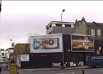

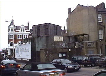

"Clapham North" [Northern, tube]
Adjacent DLS (qv) used as a hostel for male National Fire Service (NFS) personnel
from 12/05/43 (see also "Goodge Street"), until being made available as a
public ARS from 13/07 to 21/10/44, when this function ceased due to low usage
(shelter allocation transferred to Clapham South). The DLS sections were
named after famous writers (e.g. Dickens, Shakespeare, etc.). {R09/R16/Rd}
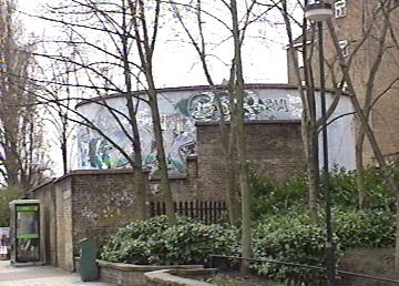
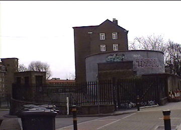


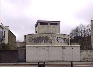
"Clapham South" [Northern, tube]
Adjacent DLS (qv) used as weekend leave accomodation for British troops from
1943, until being made available as a public ARS from 19/07/44 to 07/05/45,
although the Northern section and entrance has been closed from 21/10/44.
The DLS sections were named after famous naval commanders (e.g. Drake, Nelson,
etc.). {R09/R16/Rd}



"Cockfosters" [Piccadilly, surface]
Extensive damage to station windows as a result of bombs falling on nearby
Mount Pleasant in October 1940. {R01}
"Colindale" [Northern, surface]
Surface building severely damaged by two separate bombs during September
1940, within a few days of each other, undoubtedly due to its location adjacent
to the then-RAF Hendon (now site of the RAF Museum). On one occasion a number
of passengers on a recently-arrived train were injured by flying glass.
{R15/R14}*
C&FA: 8 killed or died at scene. Total = 8.
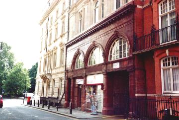
"Down Street (Mayfair)" [Piccadilly, tube]
Situated on the same branch of line as "Brompton Road" (qv), between "Green
Park" & "Hyde Park Corner," and only officially open between 15/03/07
& 21/05/32, this is the most famous of the LU "ghost" stations. Immediately
after closure, an 835-foot reversing/servicing siding was build between lines,
with access via a passageway to the east end of "Hyde Park Corner." At the
outbreak of War, the platform areas - barring a small section to allow trackside
access - were bricked-off, the spiral staircase shaft was capped with reinforced
concrete, and anti-gas measures installed. The original lifts had been removed
and the shaft converted for ventilation use, and while a small two-person
cigar-shaped lift was installed, it was rarely used due to the surface building
- while in Down Street itself, a secluded side-street off Piccadilly - having
been leased to a firm of tobacconists. Once modified, the station housed
the Emergency Railway Committee. Several sources state the War Cabinet also
used it during the heaviest raids, but others refute this. In Their Finest
Hour, Churchill described the location as a, "considerable underground
office in Piccadilly," and noted that: "from the middle of October [1940]
till the end of the year I used to go there once the firing had started,
to transact my evening business and sleep undisturbed." As at "Aldwych,"
the London Transport Museum organises tours of the station, although it has
been reported recently that these have been suspended due to a sewage-leak
problem. In lieu of this, there is an online tour on the LTM's web-site.
The small platform sections can be glimpsed briefly by the most of eagle-eyed
passengers, mid-way on the short journey between "Green Park" and "Hyde Park
Corner." The surface building also survives, with the original ground floor
entrance now housing a newsagents shop. As such, it is one of only a few
of the surviving surface buildings of the closed stations that may be entered
freely, but one would be advised to have the courtesy to buy something while
savouring this almost unique experience! The station was also used as a location
for the 1996 BBC2 fantasy television series Neverwhere.
{R07/R03/R02/Rf/Re}


"Earl's Court" [District, sub-surface; Piccadilly, tube]
From June 1942, the area of the station linking it to the adjacent Earl's
Court Exhibition Centre was used as an aircraft components factory for the
next three years, manned by volunteer London Transport workers.
East Ham Depot [District line]
Frequently hit. On one occasion, 70 vehicles were damaged by a land-mine.
Suffered V-weapon hit some time in 1944/45. {R06}
"Edgware" [Northern, surface]
Main road departure point from the capital for children evacuated via the
Underground network in 1939. {R14}
"Elephant & Castle" [Bakerloo/Northern, tube]
Minor damage by incendiary bombs 07/09/40. {R14} Damage to station by high
explosive bombs on the night of 16-17/04/41, causing suspension of traffic.
{HO 201/8} Plans to extend the Bakerloo Line to Camberwell from its terminus
at this station were suspended and then abandoned due to the outbreak of
war. While the boring of the new tunnels had begun, it is not known if they
were utilised in any wartime capacity. {R13}
"Embankment" [current District/Circle/Northern/Bakerloo] - see "Charing Cross"
"Euston Square" [Circle/Hammersmith & Chelsea/Metropolitan,
sub-surface]
Bomb-damaged platforms and surface buildings were reinforced and demolished
respectively after the War.
"Gant's Hill" [Central, tube]
Although uncompleted at the start of the War, the 2½ mile section of
tunnel already bored from where the line branches off after "Leytonstone"
at Whipps Cross to just east of this station was used by the Plessey Company
as a wartime factory for military electronic components, including wiring
sets for Halifax and Lancaster bomber, wireless equipment, field telephones,
and Enigma Code-breaking "Bombes" for Bletchley park. Access was via the
unfinished "Gant's Hill," "Redbridge," and "Wanstead" stations, as well as
temporary lift-shafts installed at Cambridge Park and Danehurst Gardens.
Work began in late-1940 and was completed by March 1942, with some of the
spoil from the central London Deep Shelters (see "Belsize Park") being used
to increase the ground cover above the tunnels near "Redbridge." The complex
eventually comprised 300,000 square feet of floor-space, served by 2,000
workers and a narrow-guaged electric railway. {R10/R02}
"Gloucester Road" [Circle/District, sub-surface; Piccadilly, tube]
Incendiary bombs penetrated lift shaft 20/02/44. {R07} Leboff does not mention
any wartime damage to this station, although he does note that the sub-surface
parts of the station (but not the tube areas) have been extensively modernised,
which may be due to the subsequent damage.
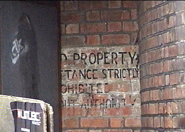
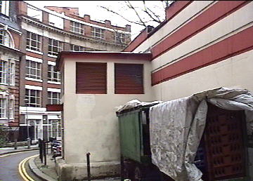
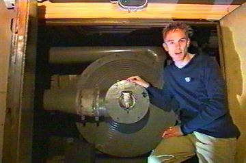
"Goodge Street" [Northern, tube]
Parts of adjacent DLS (qv) used by British and American forces - included
part as General Eisenhower's London headquarters - from 31/03/43, and as
a hostel for female NFS personnel from 12/05/43 (see also "Clapham North").
Closed completely on 03/01/44 when all users transferred to "Chancery Lane"
(qv), and utilised post-War as an army transit camp until a non-fatal fire
on 21 May 1956. The DLS sections were named after famous scientists (e.g.
Faraday, Newton, etc.). {R09/R16/Rd} V2 ballistic missile impacted near station
25/03/45, causing blast damage. {R11}
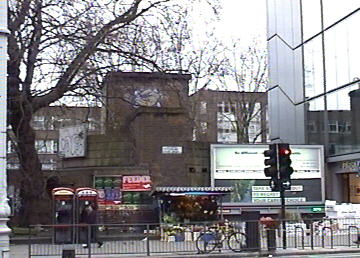



"Green Park" [Piccadilly/Victoria (now also Jubilee), tube]
Temporarily closed/access restricted for FAM 07/09/39-01/12/39. Disused areas
of the original "Dover Street" station on the site were utilised by the LT
chairman and principal officers as an ARS. {R14/R07} Two LT staff injured
by bombing 11/01/41. {R07}*
C&FA: 6 killed or died at scene,
1 injured died in hospital. Total = 7.
"Hendon Central" [Northern, surface]
See "Brent" and "Colindale."
"Highgate" [Northern, tube]
Built beneath the existing LNER surface rail station of the same name, "Highgate"
was unfinished at the start of WW2, and was used as a public ARS during the
Blitz, before being opened in an incomplete state 19/09/41 (on the same day
the existing Tube "Highgate" Tube station was renamed "Archway"). Plans to
electrify the surface track as part of the major Northern Line extension
were suspended - and later abandoned - and of two escalators installed between
the LNER station and the higher roadway, one was commandeered to replace
the severely bomb-damaged equipment at Bank (qv). {R15/R14}
"Holborn" [Central/Piccadilly, tube]
The platform serving the single line to "Aldwych" (qv) still in use closed
as a wartime measure from 21/09/40 to 01/07/46. The platform of the other
line to "Aldwych" disused since 1917 used as wartime headquarters for the
LPTB, comprising offices and dormitories. {R15/R07/R03}
"Holland Park" [Central, tube]
First refreshment service for shelterers on the open station network commenced
29/10/40 {R11}.
"Holloway Road" [Piccadilly, tube]
Tunnels severely damaged 14/10/40, preventing through service until 05/12/40.
{R07}
"Hyde Park Corner" [Piccadilly, tube]
Temporarily closed/access restricted for FAM 07/09-08/12/39. Disused areas
used for secure LT office accommodation. {R14/R07}
"Kings Cross" [Circle/Metropolitan/Hammersmith & City, sub-surface;
Northern/Piccadilly/Victoria, tube]
Northern & Piccadilly line areas temporarily closed for FAM
07/09/39-17/11/39. {R14/R07} Bomb damage on 16/10/40 necessitated the re-siting
of the sub-surface line platforms, which re-opened 14/03/41. {R15} At 23:45
on 09/03/41, two high explosive bombs struck the sub-surface Metropolitan
Line station. A signal box was burnt out, superficial damage was caused to
the booking office and station building, and the track blocked with debris.
Service resumed 11/03/41. {HO 201/7}
C&FA: 1 killed 09/03/41. Total
= 1.
With thanks to David Glennerster for notification of the 09/03/41
incident.
"King William Street" [Northern, tube]
Opened 18/12/1890 as the northern terminus after "Borough" (qv), and closed
24/02/00 when the line from the latter was extended to "Bank" via "London
Bridge" on a different tunnel alignment. During the First World War it was
suggested that the station could be used as a secret hiding place by German
spies, but a police search discovered no evidence of this and the entrance
were sealed. In 1933 the surface building was demolished and an office block
named Regis House built on the site, although the emergency staircase was
retained. During WW2 the owners of Regis House took out a lease on the station
itself and converted it into their own private two-floor shelter, with additional
access from another office block via a new staircase in Arthur Street. After
the War, the station itself continued to be used for storage purposes by
Regis House, which was recently demolished and replaced by a new building
of the same name from which access is still reportedly possible. The tunnels
now convey fibre optic cables, and the station apparently still bears evidence
of its temporary wartime role. {R15/R14/R03/R02/Rf}
"Knightsbridge" [Piccadilly, tube]
Temporarily closed/access restricted for FAM 07/09/39-01/12/39. Disused areas
used for secure LT office accommodation. {R14/R07}
"Lambeth North" [Bakerloo, tube]
First installation of steel bunks for shelterers at a Tube station 25/11/40.
Station hit by bombs 16/01/41. {R11} 20 injured.*
C&FA: 1 injured died in hospital.
Total = 1.
"Leicester Square" [Piccadilly/Northern, tube]
Location of central control room to warn appropriate Underground stations
of impending air attack. {R02} Heavy steel flood doors were visible in the
cross-passageways between the Northern and Piccadilly platforms, but these
were faced and tiled over in mid-2003, rather than being removed.
"Liverpool Street" [Circle/Hammersmith & City/Metropolitan,
sub-surface; Central, tube]
Prior to official sanction, on 08/09/40 a large crowd of shelterers gained
access to station, despite the efforts of troops and LU officials to keep
them out. Unopened sidings intended to serve the incomplete Central line
extension to "Bethnal Green" (qv) subsequently used as public ARS, with a
capacity of 10,000 people. {R10/R02}
"London Bridge" [Northern, tube]
Closed for FAM 07/09/39-18/05/40. {R15} Frequent hits in the vicinity due
to proximity to the docks. {R14}
"Maida Vale" [Bakerloo, tube]
Temporarily closed/access restricted for FAM from 07/09/39. {R14} Location
for emergency BBC studios to be used in the event of destruction of the normal
broadcasting facilities. {R02}
"Manor House" [Piccadilly, tube]
First installation of sewage ejectors for shelterers at a Tube station 01/12/40.
{R11}
"Marble Arch" [Central, tube]
Temporarily closed/access restricted for FAM from 07/09/39. {R14} Direct
hit 17/09/40 caused approximately 20 casualties - with possibly up to 7 killed
- some from wall tiles fragmenting into shrapnel. V2 ballistic missile impacted
near station (Orators' Corner, Hyde Park) 18/03/45, causing blast damage.
{R11}
"Marylebone" [Bakerloo, tube]
Surface building destroyed in air raid, with the replacement opening in early
1943. {R15}
"Mill Hill East" [Northern, surface]
Originally a surface train station, this was to have been the first part
of a pre-War proposed extension from "Finchley (Church End)" ("Finchley Central"
from 01/02/40) to "Edgware," which in turn would be extended to a depot at
Bushey Heath (qv). After war broke out, the plan was shelved, with the exception
of the initial link to "Mill Hill East" opening 18/05/41 to serve the nearby
Inglis Barracks. The rest of the extension was never completed after the
War. {R15}
"Moorgate" [Circle/Hammersmith & City/Metropolitan, sub-surface;
Northern/National Rail (WAGN), tube]
Northern and then-Northern City (now National Rail) line areas closed for
FAM 07/09/39-18/05/40. Heavy steel flood doors are visible at the foot of
the escalator linking the two sets of tube platforms. Firebombs striking
open-air section of sub-surface line 29/12/40 partially destroyed train.
See "Plaistow." {R08}
"North End" [Uncompleted - Northern, tube]
In 1903 the Charing Cross, Euston & Hampstead Railway decided to construct
a station - to be called "North End" - between "Hampstead" and "Golders Green"
in anticipation of planned residential development on Hampstead Heath. When
the Heath was acquired as a permanent public open space it became clear that
there would be no call for the station, even though it was virtually complete
at track level, barring the surface access shafts, which had not yet been
driven. The station may have been used for archival storage during WW2. Post-War
it reputedly housed the controls for the LU network flood-doors to be used
in the event of a nuclear strike on the capital. Over the years the station
acquired the name "Bull and Bush" amongst LU staff, although this is a misnomer
as the pub of that name (as immortalised the music hall song) is over a mile
away. {R03/R02}
"Notting Hill Gate" [Central, tube]
Presentation by Lord Mayor of London for £10,000 from the Lord Mayor's
Air Raid Distress Fund to the Minister of Food towards the cost of refreshments
equipment 14/11/40. {R11}
"Oakwood" [Piccadilly, surface]
A wartime pillbox built to defend the adjacent Cockfosters Depot can still
be seen on the opposite side of the main Bramley Road from the station. Service
suspended November 1940 due to delayed action bomb. {R01}
"Old Street" [Northern, tube]
Temporarily closed/access restricted for FAM from 07/09/39. {R14}
"Oval" [Northern, tube]
Temporarily closed/access restricted for FAM from 07/09/39. {R14} Although
shafts were sunk from Camberwell New Road and Church Street, work on the
adjacent DLS was abandoned in late-1941 due to persistent flooding, although
this appears to be due to the unexpected presence of a water-bearing stratum,
rather than the frequently-cited and claimed proximity to the buried River
Effra. {R09/R16/Rd}
"Oxford Circus" [Bakerloo/Central/Victoria, tube]
Temporarily closed/access restricted for FAM from 07/09/39. {R14}
"Paddington" [Bakerloo, tube]
Fire 24/12/44, no injuries.* Shelterers led through running tunnels to "Edgware
Road". {R11}
"Paddington (Praed Street)" [Metropolitan/District sub-surface]
High explosive bomb/s hit station 23:33 on 13/10/40 causing multiple fatalities,
and causing the suspension of services between "Edgware Road" and "South
Kensington." {Rb}{HO 201/3}
C&FA: 5 killed or died
at scene, 4 injured died in hospital. Total = 9.
NOTE: Although now regarded as part of the single "Paddington" complex,
"Paddington (Praed Street)" (south side of the mainline station) opened
01/10/1868 to serve the Metropolitan's "High Street Kensington" branch. It
was so named to avoid confusion with the separate "Paddington (Bishop's Road)"
station (north side of the mainline station), which opened five years earlier
as the western terminus of the first ever Underground line between there
and "Farringdon Street." "Paddington (Bishop's Road)" was renamed simply
"Paddington" on 10/09/33 (the Bakerloo line platforms opened as such on
01/12/13), while "Paddington (Praed Street)" officially only acquired the
shared name on 11/07/48, although it had actually ceased to be shown as a
separate station on Underground maps from 1934 onwards. HO201 reports and
CWGC records, however, refer only to "Praed Street," presumably for reasons
of clarity.
"Plaistow" [District/Hammersmith & City, surface]
07/09/40 one car of train standing at station blown on top of another. Wreckage
cut up on site and through-service resumed within 24 hours. {R06} Undamaged
half of one Q stock trailer car was later "cut-and-shut" combined with a
similar half of a P stock motor-car from the train otherwise destroyed at
"Moorgate" to create the unique new motor-car 14233, now preserved by the
Buckinghamshire Railway Society. {R08}
"Queens Road" [now "Queensway" - Central, tube]
18/09/41? Property above station damaged 27/06/44 by V1 flying bomb. {R11}
"Queensbury" [Bakerloo (now Jubilee), surface]
A WW2 surface bomb shelter is still visible next to the car park at the rear
of the station. {R15}
"Queensway" [current Central] - see "Queens Road"
"Ravenscourt Park" [District, surface]
Nearby viaduct damaged February and June 1944. {R07}
"St James's Park" [Circle/District, sub-surface]
Frequently hit. Section of track between this station and "Victoria" (qv)
closed when power cables in tunnel severed. {R06}
"St Mary's (Whitechapel Road)" [District/Hammersmith & City,
tube]
Situated between "Aldgate East" & "Whitechapel," and open between 01/10/1884
& 30/04/38. Early in 1940 the station was leased to Stepney Borough Council
to use as a public ARS, with the usual walls being constructed along the
track-side of the platforms to screen against passing trains, and a false
concrete ceiling installed to guard against falling masonry. Even before
this work was completed, however, the original surface building was badly
bomb-damaged on 22/10/40 and had to be demolished, while the basic replacement
structure was itself destroyed on 19/04/41. The subsequent pair of brick
shelter entrances survived on the vacant site until the 1960s, but down below
all that is visible from passing trains is the sudden and brief change of
tunnel cladding to the screen walls, which remain in situ. {R15/R03/Rf}
"St Paul's" [Central, tube]
The surface building to the original lift-served "Post Office" station -
closed shortly before the War when superseded by escalators from a different
entrance bearing the new name - was severely damaged in a 1940 air raid,
and demolished twenty years later. {R15} 7 injured 11/01/41.* Construction
of the adjacent DLS ceased in August 1941 due to fears that it would undermine
the Cathedral. Some sources suggest that the partly-completed works were
taken over by the Central Electricity Board as their wartime underground
headquarters, when in fact this was situated in disused lift-shafts of the
"Post Office" station, which had not been too adversely affected by the bombing
of the surface building. {R09/R16/Rd}
"Shepherd's Bush" [Central, tube]
Death of shelterer falling against train 20/11/40 {R11}.
"Sloane Square" [Circle/District, sub-surface]
Direct hit 10pm 12/11/40 demolished a previous reconstruction only completed
27/03/40. Large concrete fragment landed on roof of one car of departing
train, injuring 79. Rebuilt post-War.
{R15/R06}
C&FA: 35 killed or died at scene, 2 injured died in hospital. Total
= 37.
"South Kensington" [Circle/District, sub-surface; Piccadilly, tube]
First installation of a medical aid post for shelterers at a Tube station
20/12/40 {R11} Disused areas of Piccadilly Line section used for secure LT
office accommodation. {R07} In the late 1880s it had been intended to construct
an express District Line tunnel between "Earl's Court" and "Mansion House,"
with just one intermediate station at "South Kensington." This plan was
eventually shelved, and the 120-ft section of station tunnel adjacent to
the "South Kensington" westbound Piccadilly Line platform was turned into
a signalling school. During the War part of the tunnel was used to house
electronic equipment to monitor the effect of time-delay bombs, and as a
store for LT's emergency engineering equipment. The public tunnel under
Exhibition Road linked it to the underground Civil Defence headquarters beneath
the Natural History and Geological Museums. {R15/R16/R04}
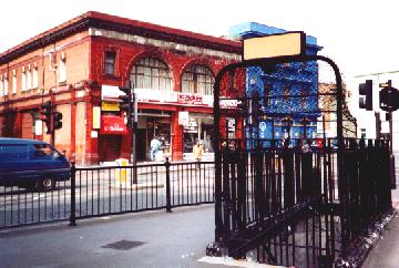
"South Kentish Town" [Northern, tube]
Situated between "Kentish Town" & "Camden Town" (qv), this station enjoyed
a brief working life between 22/06/07 and 05/06/24, closing during a labour
strike and not reopening, save as a public ARS during the War. For this purpose,
the lift shaft was capped, the platform bricked off from the tracks, and
a false floor installed. Shelter opened 10/02/41. Although the platforms
have since been removed, as a designated emergency exit, it is lit and clearly
visible from passing trains (on the right-hand side of the direction of travel).
The distinctive surface building survives as commercial premises at the corner
of Castle Road and Kentish Town Road. {R15/R14/R03/R11/Ra/Rf}

"South Wimbledon" [Northern, tube]
Last dismantling of bunks and medical aid post on the open station network
31/05/45. {R11}
"Stepney Green" [District/Hammersmith & City, sub-surface]
Damaged 10/05/41. {R15}
"Stockwell" [Northern/now also Victoria, tube]
Adjacent DLS (qv) used as a hostel for British troops from 23/01/43, as weekend
leave accomodation for American troops from September 1943, until being made
available as a public ARS from 09/07/44 to 07/05/45, although the Southern
section and entrance has been closed from 21/10/44. The DLS sections were
named after famous artists or architects (e.g. Constable, Wren, etc.).
{R09/R16/Rd} During the building of the new Victoria Line areas in the
late-60s/early-70s, some of the access passages to the DLS were re-sited.
{R12}


"Strand" [now combined with old Bakerloo line "Trafalgar Square" (qv)
and now defunct Jubilee line terminus as "Charing Cross" - Northern, tube]
Closed for FAM 28/09-07/10/38 & 01/09-17/12/39. {R15} This station should
not be confused with "Aldwych" (qv), which was also called "Strand" in its
early working life.
"Tooting Bec" [current Northern] - see "Trinity Road (Tooting Bec)"
"Tooting Broadway" [Northern, tube]
Temporarily closed/access restricted for FAM (date unknown), which prevented
flooding when a water main outside the station was breached by a bomb-hit
07/10/40. The heavy steel flood doors can still be seen on the lower concourse
level. {R14}
"Tottenham Court Road" [Central/Northern, tube]
Temporarily closed/access restricted for FAM from 07/09/39. {R14} Again,
no mention of wartime damage by Leboff, although the station was rebuilt
in 1965. {R15} Station damaged 24/09/40 {R11}, 1 killed*. Bedding disinfectant
storeroom appointed 01/11/40 {R11}.
"Trafalgar Square" [now combined with old Northern line "Strand" (qv)
and now defunct Jubilee line terminus as "Charing Cross" - Bakerloo, tube]
12/10/40 bomb penetrated and exploded at the head of the escalator. Subsequent
avalanche of wet earth killed 7 shelterers on the platform area. {R02/R11}*
33 injured. {R11}
C&FA: 7 killed or died at
scene. Total = 7.
"Trinity Road (Tooting Bec)" [now "Tooting Bec" - Northern, tube]
Temporarily closed/access restricted for FAM from 07/09/39. {R14}
"Turnpike Lane" [Piccadilly, tube]
Unknown incident 05/01/41.
C&FA: 1 injured died in hospital.
Total = 1.
"Upminster Park [District, surface]
Although there is no direct WW2 information on this station, opened 17/12/34,
Leboff notes that in the ticket hall, "the tiled floor finish features a
distinctive black and purple pattern against a brown terrazzo background..."
The "distinctive pattern" is in fact a large swastika, with its corners cut
off at 45 degrees to match the octagonal shape of the hall! {R15}
"Victoria" [Circle/District, sub-surface; Victoria, tube]
10/05/41 UXB closed station for seven days. {R15}
"Wapping" [Metropolitan (now East London), sub-surface]
Bomb damage 11/09/40. {R15} Destroyed by firebombs. {R08}
"Waterloo" [Bakerloo/Northern, tube]
Northern line platforms closed for FAM 28/09-07/10/38 & 01/09-16/12/39.
The station had to be closed to shelterers 15/03/43 as a result of difficulty
of clearing the platforms in the event of flood-door damage. See also "City."
{R15/R14/R11}
"West Kensington" [District, surface]
A WW2 ARS is still located behind the retaining wall on the eastbound platform.
{R15}
"Whitechapel" [District/Hammersmith & City, surface; East London,
sub-surface]
Station frequently hit, perhaps because of close proximity to the Docks,
but adjacent electricity sub-station may also have been a target. Badly damaged
March 1941. Service between this station and "Bow Road" suspended for two
days following the raid of 10/05/41. {R06}
"Wood Lane (White City)" [Hammersmith & City, surface]
This station, between the present day H&C "Shepherd's Bush" and "Latimer
Road" was opened 01/05/08 as "Wood Lane (Exhibition)" to serve the Franco-British
Exhibition and last saw regular use 01/11/14. It was reopened for one day
05/11/20 as "Wood Lane (White City)" for a motor show and was thereafter
only occasionally to serve greyhound racing as the adjacent White City Stadium.
In November 1940 part of the eastbound platform was destroyed by a bomb.
Renamed "White City" 23/11/47 and last used 24/10/59, a fire damaging one
of the platforms the next day. Demolished Spring 1961. {R04} "Wood Lane (White
City)" was located on the north-west side of Macfarlane Road, while at the
time of opening the H&C "Shepherd's Bush" was situated between Goldhawk
Road and Uxbridge Road. The latter station closed 31/03/14 and the current
site 250m to the north of the original and just 200m from "Wood Lane
(Exhibition)" (as it still was) opened the next day, as did the new "Goldhawk
Road", just south of the named thoroughfare. This station should not be confused
with the Central line "Wood Lane", which opened 14/05/08, also to serve the
Franco-British Exhibition. It closed 22/11/47, being superseded the next
day by the present "White City" further to the north.
"Wood Green" [Piccadilly, tube]
On 31/10/40, H Chubb, the Town Clerk of the then-Borough of Wood Green, wrote
to PGW Gosse, the ARP officer for the County of Middlesex:
"A few years ago, when the plans for the running of the Underground Railway through Wood Green were under consideration, the London Passenger Treansport Board seriously entertained the idea of extending the Tube from Wood Green to the Alexandra Palace, and if plans were not actually prepared, the Board had, I believe, in mind the course such an extension could follow. It seems to my Council that if the tunnels necessary for this projected extension could be bored now... it would make an ideal public shelter for the locality and would go a long way towards the complete solution of the local shelter problem. Suitable access-ways could be made from the neighbouring highways, and the Tube could probably be divided temporarily into sections, so as to avoid the danger of having too large a number of the public in a single shelter. The predominant advantage of such a scheme would be that it would fill an immediate and pressing need, and when hsoitilities are over the works could quickly be converted into a very valuable peace-time use, there being no waste in the initial capital outlay."The tunnels suggested above would... extend westwards, from Wood Green Underground Station and a furthur proposal is made that there should be a corresponding extension eastwards in the direction of Bruce Grove, Tottenham. Here again the additional Tube would serve congested areas where effective shelter is urgently needed, and similar adaptation of the Tube as an Underground Railway could be effected after the War."
This came just 18 days after the heavy loss of live in the bombing of "Bounds Green" (qv) - the station immediately north of "Wood Green" - when no doubt the need for shelter provision in the Borough was being felt at its most acute. Gosse referred the proposal to higher authorities, and eventually attention was drawn to the Ministry of Home Security's "Circular No. 284/1940" (22/11/40), which outlined the governing principles relating to "Deep Tunnel Shelters." The Circular was issued to all local authorities in England, Scotland and Wales, but included the specific statement that, "Local authorities in London will understand that they need not take the initiative as regards tunnels associated with the London Tube as these will be dealt with centrally."
The initial proposal, however, does raise some questions, not least being that when the Piccadilly Line was extended from "Finsbury Park" in the late-1920s, although a number of options were considered for the route the line would take beyond "Wood Green," one via Alexandra Palace does not appear to have been amongst them. On the other hand, Chubb's reference to, "a few years ago," suggests there may have been some confusion over the amalgamation with the Northern Line of the former LNER branch from "Finsbury Park," which terminated at a station adjacent to Alexandra Palace and bearing that name (this is not the same as the current National Rail station of the same name). Nevertheless, the scheme outlined for "Wood Green" seems to suggest a branching of the existing Piccadilly Line in two directions, as opposed to largely separate DLS-style tunnels, so one can only speculate as to how - or even if - it could have been utilised after the War. {HO 207/963}
"York Road" [Piccadilly, tube]
This station was situated in the middle of the long stretch of the Piccadilly
line between "King's Cross" and "Caledonian Road," with a substantial surface
building at the junction of York Road (now York Way) and Bingfield Street,
and is unusual in as much as it is the only one of the numerous tube stations
closed during the 1920s/30s - specifically 19/09/32, the same day the line
extension from Finsbury Park to Arnos Grove opened - that was not
pressed into service as an ARS during WW2. This may be for the same reasons
that it was closed in the first place, namely that the area is largely
industrial, and sparsely populated. Just as not enough people used the station
during its operating lifetime, it was probably decided that an ARS would
get a similarly low patronage, although the close proximity to the surface
King's Cross rail station may have led planners to believe that it was in
too obvious a target area anyway. Despite this, the surface building survived
the war intact and is currently in commercial use, although there is simmering
speculation that York Road could be resurrected to serve the planned Kings
Cross international rail terminal, as it will be located to the north of
the existing surface station. {R03/R04/Rf}
Along with those listed above, there are a further 14 disused stations on redundant lines, mostly surface types, all of which closed pre-War with the exception of "Uxbridge Road" on 19/10/40. There are a further four stations on active lines that are no longer used. Two closed before WW2, and two afterwards. "Marlborough Road" and "Lord's (St John's Wood)" shut 19/11/39, and "Swiss Cottage" on 17/08/40. Three other stations were re-sited before WW2, and two afterwards.
REFERENCES/PUBLISHED SOURCES:
{R01} Piccadilly Line Extension - The Diamond Anniversary (Barry
Carpenter, 1992, Piccadilly Line [East Area])
{R02} Subterranean City (Antony Clayton, 2000, Historical Publications,
ISBN 0-948667-69-9)
{R03} London's Disused Underground Stations (J.E.Connor, 1999, Connor
& Butler Specialist Publishers, ISBN 0-947699-29-5)
{R04} Abandoned Stations on London's Underground (J.E.Connor, 2000,
Connor & Butler Specialist Publishers, ISBN 0-947699-30-9)
{R05} London's Disused Underground Stations (J.E.Connor, 2001)
{R06} Going Green - The Story of the District Line (Piers Connor,
1993, Capital Transport Publishing, ISBN 1-85414-162-7)
{R07} The Piccadilly Line - An Illustrated History (Desmond F.Croome,
1998, Capital Transport Publishing, ISBN 1-85414-192-9)
{R08} The Story of the London Underground (John R Day & John Reed,
1963/8th edition 2001, Capital Transport, ISBN 1-85414-243-3)
{R09} London's Secret Tubes (Andrew Emmerson & Tony Beard, 2004,
Capital Transport, ISBN 1-85414-283-6)
{R10} The Twopenny tube - The Story of the Central Line (J.Graeme
& Desmond F.Croome, 1996, Capital Transport Publishing, ISBN
185414-186-4)
{R11} The Shelter of the Tubes (John Gregg, Capital Transport
Publishing,ISBN 185414-244-5)
{R12} The Victoria Line (M.A.C. Horne, 1988, Douglas Rose, ISBN
1-870354-02-8)
{R13} The Jubilee Line - An Illustrated History (Mike Horne, 2000,
Capital Transport Publishing, ISBN 1-85414-220-8)
{R14} The Northern Line - An Illustrated History (Mike Horne &
Bob Bayman, 1990, Capital Transport Publishing, ISBN 85414-208-9)
{R15} London Underground Stations (David Leboff, 1994, Ian Allen Ltd.,
ISBN 0-7110-2226-7)
{R16} London Under London - A Subterranean Guide (Richard Trench &
Ellis Hillman, 1984 John Murray Publishing Ltd, ISBN 0-7195-4617-6)
{R17} Tragedy at Bethnal Green (1999, The Stationery Office Publishing,
ISBN 0-11-702404-X)
REFERENCES/DOCUMENTS HELD AT THE NATIONAL ARCHIVES, KEW, RICHMOND, SURREY [ www.nationalarchives.gov.uk]
{HO 186/639} AIR RAIDS, London Region: enquiry into Bank tube station
bomb incident. & CASUALTY SERVICES, London Region: enquiry into
Bank tube station bomb incident.
{HO 196/11} Notes on damage to railway tunnels by high explosive weapons,
Section 1 - Tube railways {HO 207/963} Civil Defence Region No 5 (London):
Wood Green - Public shelters including trenches and tube stations
{HO 201/3} Ministry of Home Security: Key Points Intelligence Directorate:
Reports and Papers\Daily Reports\October 1940
{HO 201/7} Ministry of Home Security: Key Points Intelligence Directorate:
Reports and Papers\Daily Reports\February - March 1941
{HO 201/8} Ministry of Home Security: Key Points Intelligence Directorate:
Reports and Papers\Daily Reports\April 1941
REFERENCES/INTERNET RESOURCES
{Ra} http://members.tripod.co.uk/raggajohn/northerndis.html
{Rb} http://www.btp.police/
{Rc} http://www.fortunecity.co.uk/meltingpot/oxford/330/shel/shel4.html
{Rd} http://www.fortunecity.com/marina/greenland/0/new/t_london.htm
{Re} http://www.google (Usenet postings r.e.DLS's)
{Rf} http://www.ltmuseum/
{Rg} http://www.starfury.demon.co.uk/uground/
{Rh} http://www.subbrit.org.uk/rsg/sites/k/kingsway/
14/04/02 |
First upload |
16/04/02 |
Images added |
06/05/02 |
Corrections/images added |
20/09/03 |
Corrections/reformatting |
01/10/03 |
Minor reformatting |
13/10/03 |
Major additions/corrections |
| 15/01/04 | Minor additions/corrections |
08/03/04 |
Minor corrections/reformatted |
21/07/04 |
New images/amendments |
10/10/04 |
New additions/links |
12/10/04 |
New link |
14/10/04 |
New link |
| 19/10/04 | Corrections |
21/11/04 |
New images/text (DLSs & "Borough"); |
20/04/05 |
New text ("Paddington (Praed Street)") |
07/07/05 |
New text/corrections (new introduction; Phillips Report) |
| 09/07/05 | Temporarily relocated to www.625.org.uk |
| 05/06/06 | Minor corrections; new link; ransferred back from www.625.org.uk |
| 06/01/09 | Amendments |
| 11/05/10 | Balham fatality figure updated |
| 16/08/10 | Sloane Square fatality figure updated |
| 27/09/10 | Colindale CAFA |
05/10/10 |
Charing Cross CAFA |
31/01/14 |
LUAW details |
| 22/10/17 | Hosting transfer & amendments |